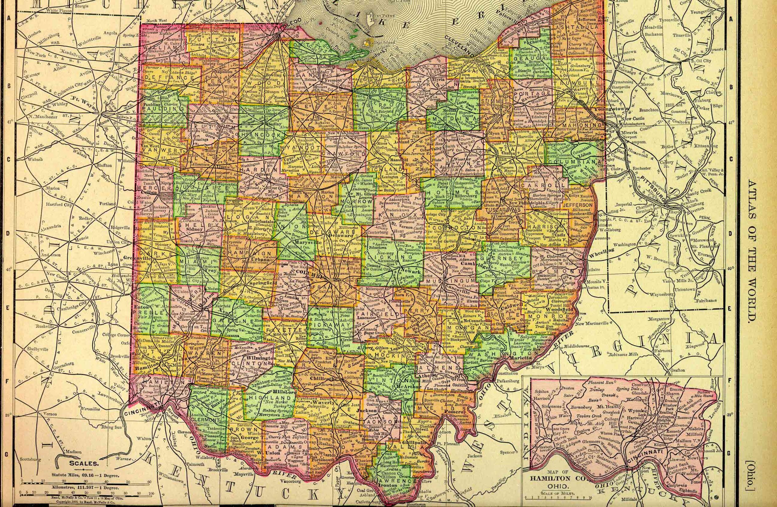
Ohio, one of the north central United States, is bounded on the north by Michigan and Lake Erie; on the east by Pennsylvania and West Virginia; on the south by Kentucky, from which it is separated by the Ohio River; and on the west by Indiana. It lies between about 38º 27′ and 41º 58′ north latitude, and between 80º 31′ and 84º 49′ west longitude. The state measures about 220 miles from north to south and about 230 miles from east to west. It contains approximately 44,826 square miles, or 28,688,640 acres.
This state project is part of the much larger American History & Genealogy Project or better known by the abbreviation of AHGP. It has been in existence online since 2000 and over the years has been spread out across the web. These pages are an attempt to consolidate it under one website of the larger project.
Ohio Information
Ohio History
- A Few Firsts in Ohio
- Ohio Military Forts
- Hamilton County Enlarged
- Randolph and Wayne Counties
- Hamilton County Extended
- Controversy over New Counties
- Division of the Northwest Territory
- The State Formed
- Trumbull County
- Washington and Hamilton Counties
Tuscarawas and Muskingum Valley Resources
- Early Settlers and Incidents in Coshocton County
- Early Settlers of Morgan and Muskingum Counties
- Early Settlers and Prominent Men in Stark County
- First Houses, Mills, Stores, in Tuscarawas County
- Oldest Inhabitants, of the Tuscarawas Valley
- Bucks to Lawrence Township
- One Leg to York Township
- Death Roll ~ Tuscarawas Valley, Ohio
- Gateways to Fort Ancient
- Old Fort Industry
- Fort Miami and Fort Industry
Ohio Genealogy
Ohio Counties
- Adams County
- Athens County
- Auglaize County
- Butler County
- Carrol County
- Guernsey County
- Highland County
- Jackson County
- Knox County
- Meigs County
- Mercer County
- Montgomery County
- Muskigum County
- Stark County
- Van Wert County
- Wayne County

Back to: American History & Genealogy Project