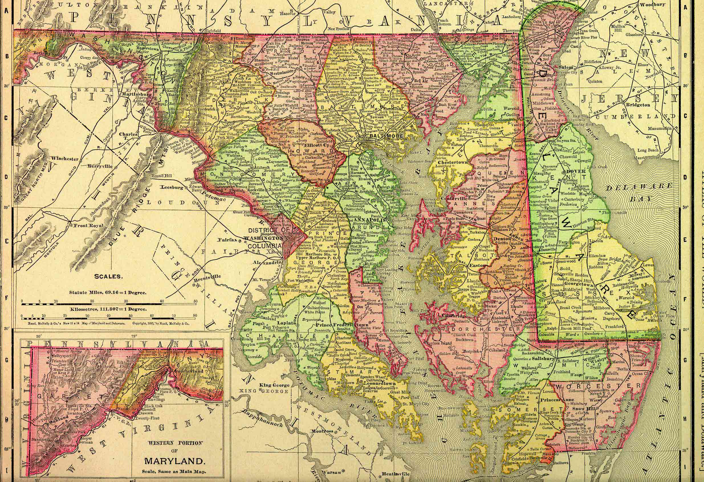
Maryland, one of the middle Atlantic states, is bounded on the north by Pennsylvania; on the east by Delaware and the Atlantic Ocean; on the south and west by Virginia and West Virginia, from which it is separated in part by the Potomac River. It lies between about 37º 53′ and 39º 43′ north latitude, and between 75º 4′ and 79º 29′ west longitude. The state measures about 250 miles from east to west and about 100 miles from north to south at its widest, though it narrows to less than 2 miles near Hancock. It contains approximately 12,407 square miles, or 7,940,480 acres.
This state project is part of the much larger American History & Genealogy Project or better known by the abbreviation of AHGP. It has been in existence online since 2000 and over the years has been spread out across the web. These pages are an attempt to consolidate it under one website of the larger project.
Maryland Information
- 1904 Gazetteer of Maryland
- Maryland County Courthouses in 1901
- Maryland Slaves
- Origin of Maryland County Names
Maryland History
- Confederate Soldiers at Hagerstown and Williamsport, 1863
- Maryland Military Forts
- News from the Maryland and Green’s Gazette (little tidbits of news)
- Peggy Stewart and her Cargo
- Principal Dates in the History of Maryland
- War of 1812
Maryland Genealogy
Maryland Counties
- Allegany County
- Anne Arundel County
- Baltimore County
- Baltimore City
- Calvert County
- Caroline County
- Carroll County
- Cecil County
- Charles County
- Dorchester County
- Frederick County
- Garrett County
- Harford County
- Howard County
- Kent County
- Montgomery County
- Prince George’s County
- Queen Anne’s County
- St. Mary’s County
- Somerset County
- Talbot County
- Washington County
- Wicomico County
- Worcester County

Back to: American History & Genealogy Project