
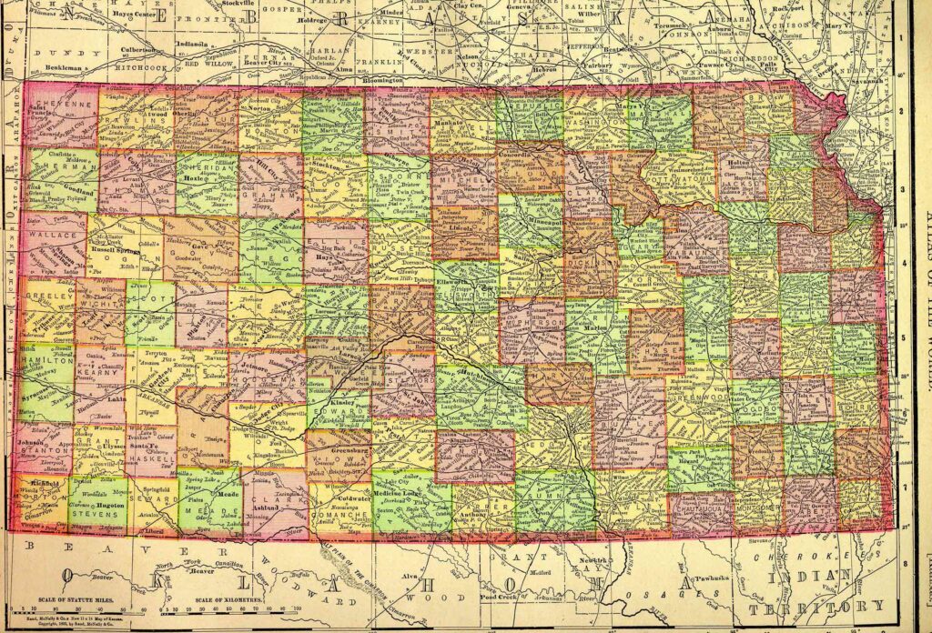
Kansas, one of the central United States, is bounded on the north by Nebraska; on the east by Missouri; on the south by Oklahoma; and on the west by Colorado. It lies between about 37º and 40º north latitude, and between 94º 35′ and 102º west longitude. The state measures about 210 miles from north to south and about 410 miles from east to west. It contains approximately 82,278 square miles, or 52,658,000 acres.
Kansas, located in the central United States, was originally inhabited by Native American tribes including the Kansa (Kaw), Osage, Pawnee, and Wichita, with the region part of the larger Great Plains cultural area. The area became part of the United States through the Louisiana Purchase in 1803, and formal U.S. control expanded with military expeditions and forts such as Fort Leavenworth (est. 1827). Kansas Territory was organized on May 30, 1854, and statehood followed on January 29, 1861. County boundaries began forming in the 1850s, with many county governments established and functional by the 1860s; most county-level land, court, probate, and vital records begin around this time. Early settlements concentrated along major rivers like the Kansas and Missouri, and along trails such as the Santa Fe and Oregon Trails, which crossed the state. Land records are primarily held at county courthouses, with federal land patents issued after settlement under the Homestead Act of 1862. Many townships and towns were established in conjunction with railroad expansion in the 1870s and 1880s, influencing migration and recordkeeping.
This state project is part of the much larger American History & Genealogy Project or better known by the abbreviation of AHGP. It has been in existence online since 2000 and over the years has been spread out across the web. These pages are an attempt to consolidate it under one website of the larger project.
Kansas Information
Kansas History
Kansas Genealogy
- Chautauqua County Kansas Directories. 1878
- Coffee County, Kansas, 1878 Farmers’ Directory
- Crawford County Kansas, 1878 Farmers’ Directory
- Ford County Kansas Directories, 1884-1885
- Jefferson County Kansas Directories, 1878
- Jefferson County Kansas Directories, 1894
- Jewell County Kansas Directories, 1880
- McPherson County, Gazetteer and Business Directory, 1878
- Norton County Kansas Directories, 1912
- Rice County Kansas Gazetteer, 1912
- Wyandotte County Kansas Directories, 1894
- Woodson County Kansas Directories, 1884-1885
Kansas Counties
- Allen County
- Anderson County
- Atchison County
- Barber County
- Barton County
- Bourbon County
- Brown County
- Butler County
- Chase County
- Chautauqua County
- Cherokee County
- Cheyenne County
- Clark County
- Clay County
- Cloud County
- Coffey County
- Comanche County
- Cowley County
- Crawford County
- Decatur County
- Dickinson County
- Doniphan County
- Douglas County
- Edwards County
- Elk County
- Ellis County
- Ellsworth County
- Finney County
- Ford County
- Franklin County
- Geary County
- Gove County
- Graham County
- Grant County
- Gray County
- Greeley County
- Greenwood County
- Hamilton County
- Harper County
- Harvey County
- Haskell County
- Hodgeman County
- Jackson County
- Jefferson County
- Jewell County
- Johnson County
- Kearny County
- Kingman County
- Kiowa County
- Labette County
- Lane County
- Leavenworth County
- Lincoln County
- Linn County
- Logan County
- Lyon County
- Marion County
- Marshall County
- McPherson County
- Meade County
- Miami County
- Mitchell County
- Montgomery County
- Morris County
- Morton County
- Nemaha County
- Neosho County
- Ness County
- Norton County
- Osage County
- Osborne County
- Ottawa County
- Pawnee County
- Phillips County
- Pottawatomie County
- Pratt County
- Rawlins County
- Reno County
- Republic County
- Rice County
- Riley County
- Rooks County
- Rush County
- Russell County
- Saline County
- Scott County
- Sedgwick County
- Seward County
- Shawnee County
- Sheridan County
- Sherman County
- Smith County
- Stafford County
- Stanton County
- Stevens County
- Sumner County
- Thomas County
- Trego County
- Wabaunsee County
- Wallace County
- Washington County
- Wichita County
- Wilson County
- Woodson County
- Wyandotte County
Back to: American History & Genealogy Project