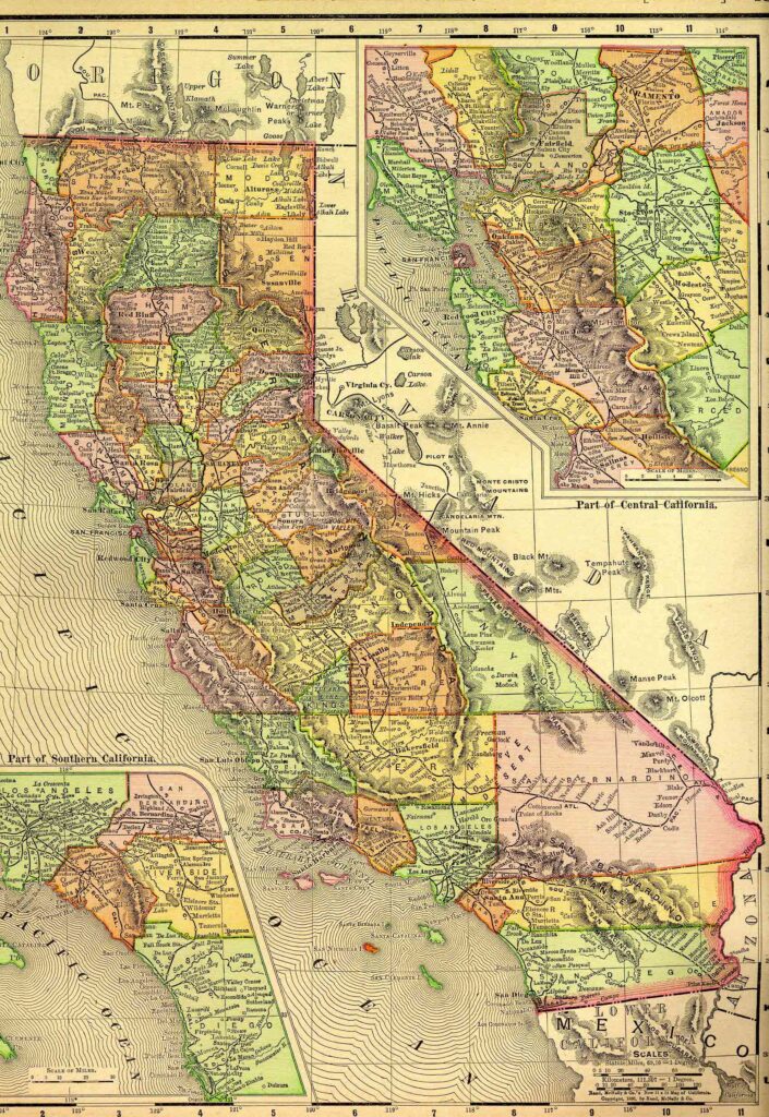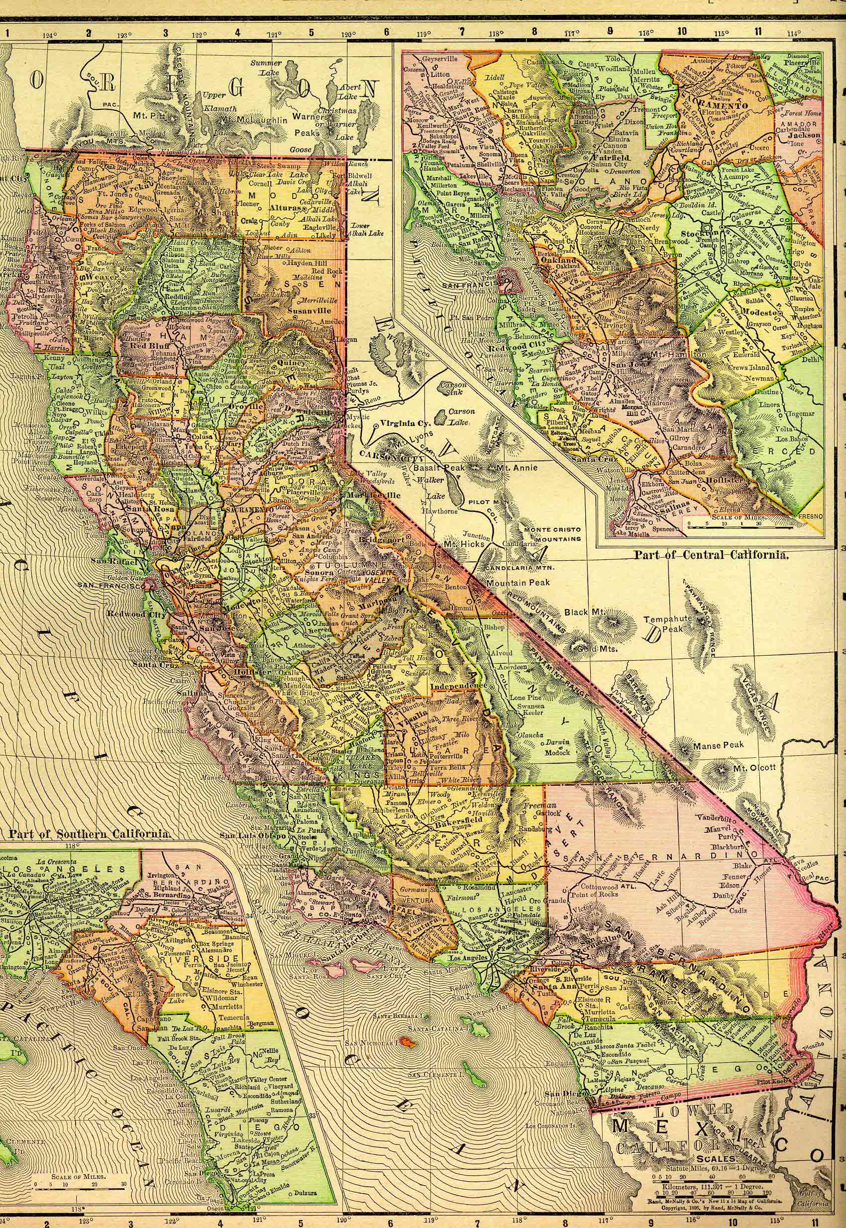
California, the westernmost of the contiguous United States, is bounded on the north by Oregon; on the east by Nevada and Arizona; on the south by the Mexican state of Baja California; and on the west by the Pacific Ocean. It lies between approximately 32º 30′ and 42º north latitude, and between 114º 8′ and 124º 26′ west longitude. The state stretches about 770 miles from north to south and varies from 150 to 250 miles in width from east to west. It contains an area of roughly 163,696 square miles, or 104,765,440 acres.
This state project is part of the much larger American History & Genealogy Project or better known by the abbreviation of AHGP. The larger project has been in existence online since 2000 and over the years it spread out across the web. These pages are an attempt to consolidate all the smaller pieces under the website of the larger project.
California Information
- California Counties in 1890
These descriptions of California counties were taken from volume II of California State Gazetteer and Business Directory, R. L. Polk & Company, published in 1890. They give you an idea of the counties as they were at that point in history. - Southern California Place Names
- West Coast Gazetteer & Directory – California
California History
- California Military Forts
- Camel Caravans of the American Deserts
- First-Person Narratives of California’s Early Years, 1849-1900
This collection covers the dramatic decades between the Gold Rush and the turn of the twentieth century. It captures the pioneer experience; encounters between Anglo-Americans and the diverse peoples who had preceded them; the transformation of the land by mining, ranching, agriculture, and urban development; the often-turbulent growth of communities and cities; and California’s emergence as both a state and a place of uniquely American dreams. - Mexican Governors of California
- Los Angeles
- Mining and Gold
- Missions
- Pony Express
California Genealogy
- Directories
County Projects